Geography
What follows is a set of journal entries and accompanying maps from an unfinished compilation of maps drawn by the Most Honorable Royal Company of Surveyors of Gewisse. They disappeared in the endeavor.
Their effects along with their writings were discovered in a market stall in Luden. The journal and maps were purchased and distributed by Philippa Grist, publisher of the Luden Gazette.
Ludenesse
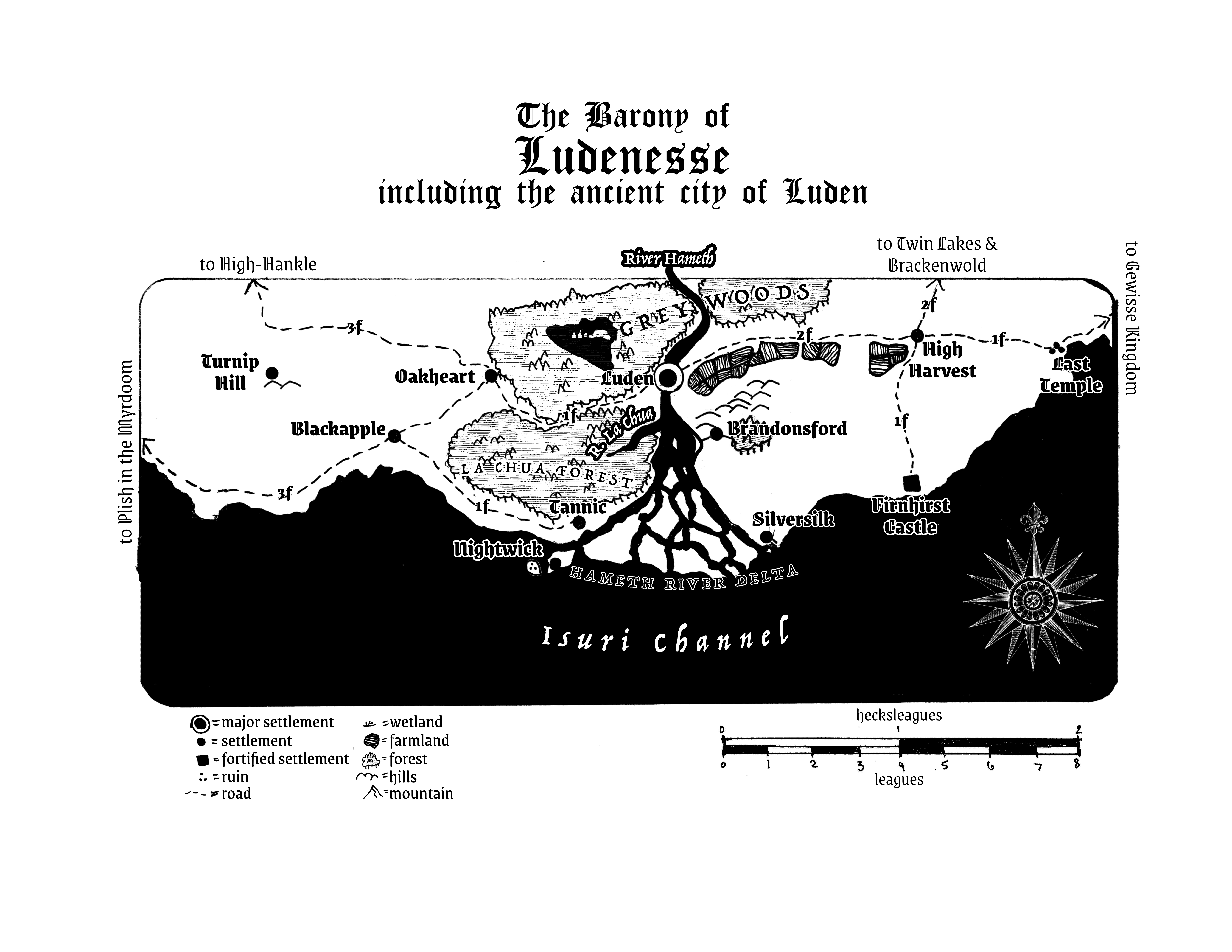
The Baron of Ludenesse Alfhelm first invited us to his castle Firnhirst, a prearranged rest on the way from Gewisse on the long road. It was a strange and eerie dinner. Odd man. We left quickly and did not stay the night. We found an inn on the way to Luden and stayed there instead.
Luden is as grimy and awful as the rumors say. Its bridge spanning the River Hameth is choked with hovels, markets, and livestock. Whatever former glory the Old Werriadi imbued in this place is long gone. At the Underbridge Pub, we learned as much as we could from some fools on their way to Nightwick Abbey to plunder its depths. They told us of the swampy Hameth River Delta, full of frogling foreigners and strange spirits. There is word of a lake in the middle of the Grey Woods north of Luden while sinkholes pepper the land south of Luden.
The adventurers measured the distances (when asked) in farsa, which is about how long someone can travel in 8 hours. A strangely specific yet vague measure since it can span several leagues on horseback and very few through rough mountains. We have noted these measurements on the roads with “f” but have eschewed any mention of rumored or legendary sites as nonsense. Those fools left and some Aegerling brutes forced us to pay for their drinks and we took our leave quickly. Not much to see in this godforsaken city.
The High Wold and Hag’s Addle
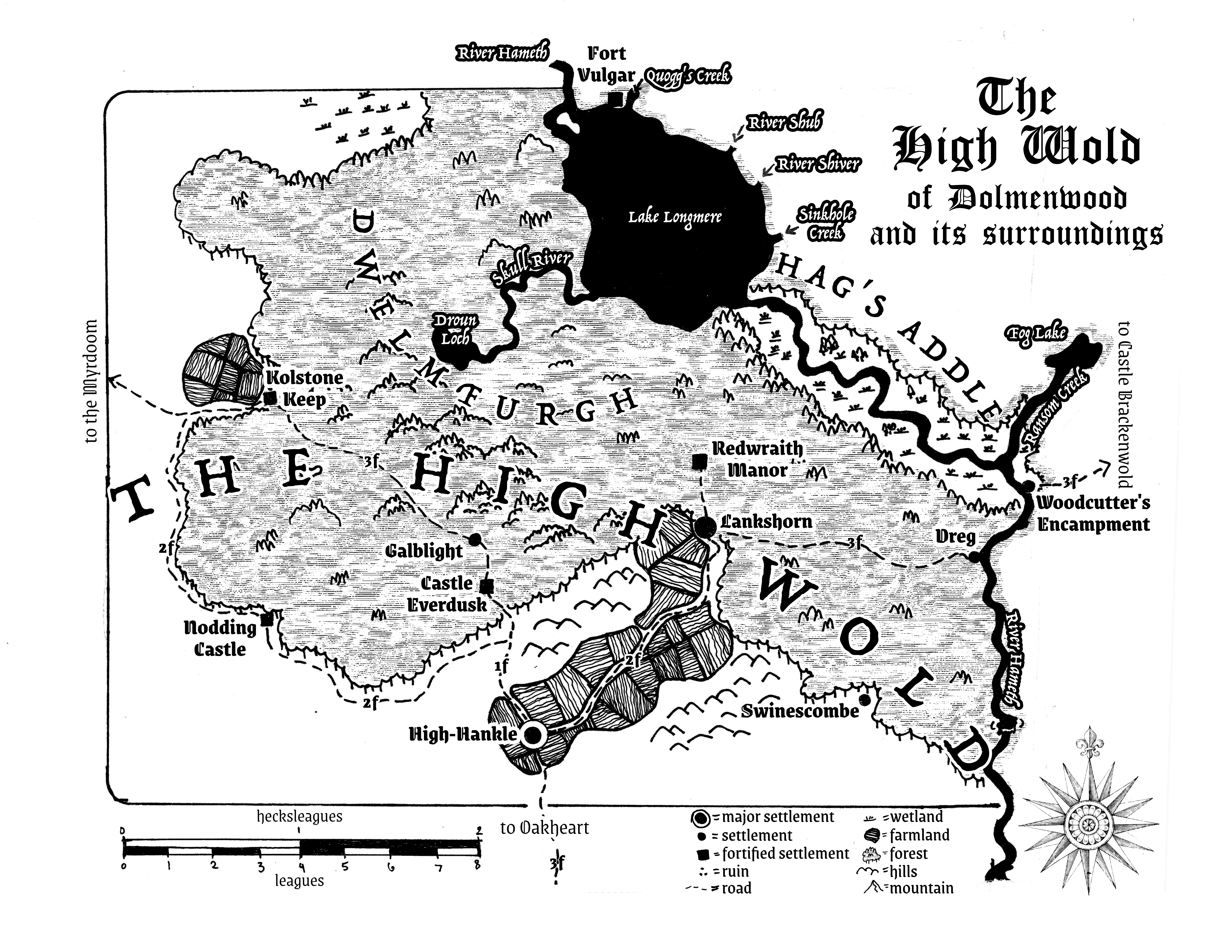
The High Wold, the old homeland of the breggles, forms the southwestern part of the Duchy of Brackenwold. We stayed in High-Hankle and visited a pub there to talk to the locals. We based our map of the High Wold and its surroundings on this information because we decided (except Willem but he was outvoted) that based on what adventurers get paid and what pittance the Surveyors’ office was paying that it wasn’t worth the risk. We weren’t measuring farmsteads here. Plus our petty cash was taken by those Aegerlings.
The adventurers said that the Dwelmfurgh and its standing stones remain an enigma and said some nonsense about Drunes and fairies. We ignored the poorly described trails they mentioned deep in the woods and just marked the major roads.
The Tithelands, Mulchgrove, and Aldweald
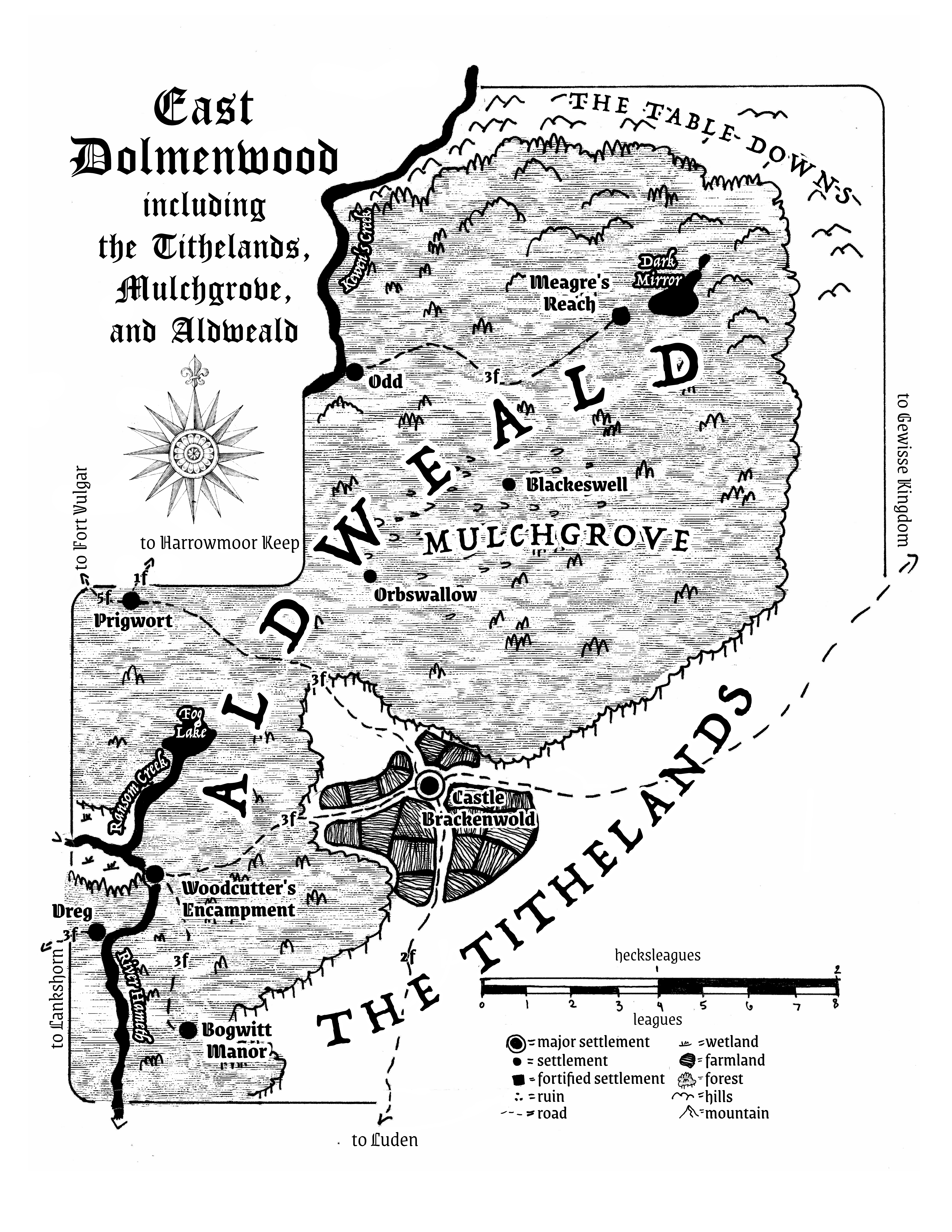
We doubled back through Luden to reach Castle Brackenwold. The civilised Tithelands, a true respite from the rest of this country, is overseen by the Duke of Brackenwold himself. We conferred with local students at the pub about the details of Aldweald and the mossling homeland of Mulchgrove before girding ourselves for the ride to Prigwort. Having to go into the forest of Dolmenwood itself, even via road, felt perilous.
This was not what I signed up for. Scratch that, I think drinking at pubs is what I signed up for. This map is good enough for a foolish king who will never visit these parts.
The Northern Scratch, Fever Marsh, and the Valley of the Wise Beasts
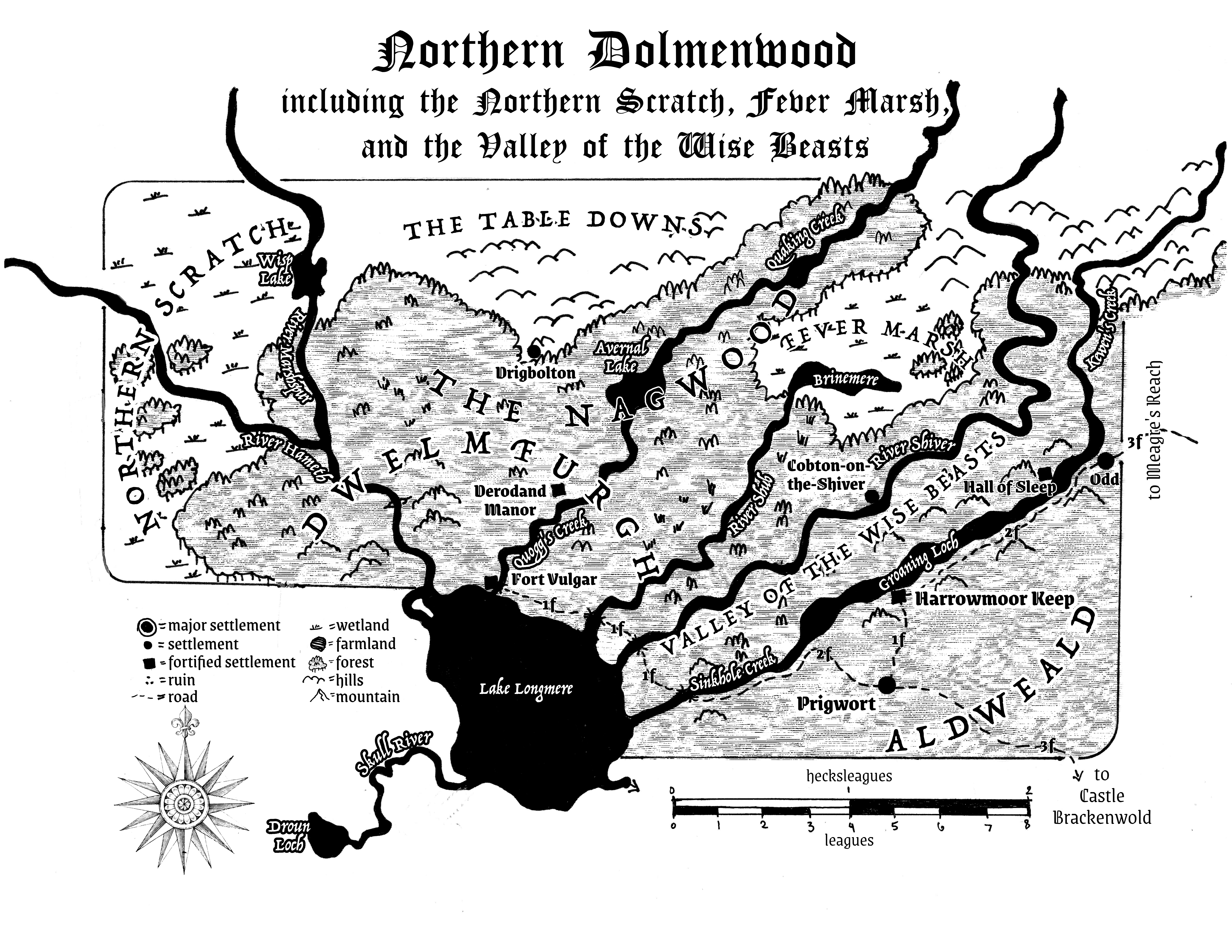
At Prigwort, we had a raucous good time. A grim-faced breggle woman told us of the northern parts of Dolmenwood and the lands beyond the borders of the Duchy Brackenwold. Nothing we’d like to see, we agreed, and drew the map based on the woman’s descriptions, leaving out the fanciful details of ruins and twisted breggle-monsters and talking animals and the standing stones and fairy nonsense. We decided it was best to double back once more through Luden. No need to traipse beyond.
Ruislip
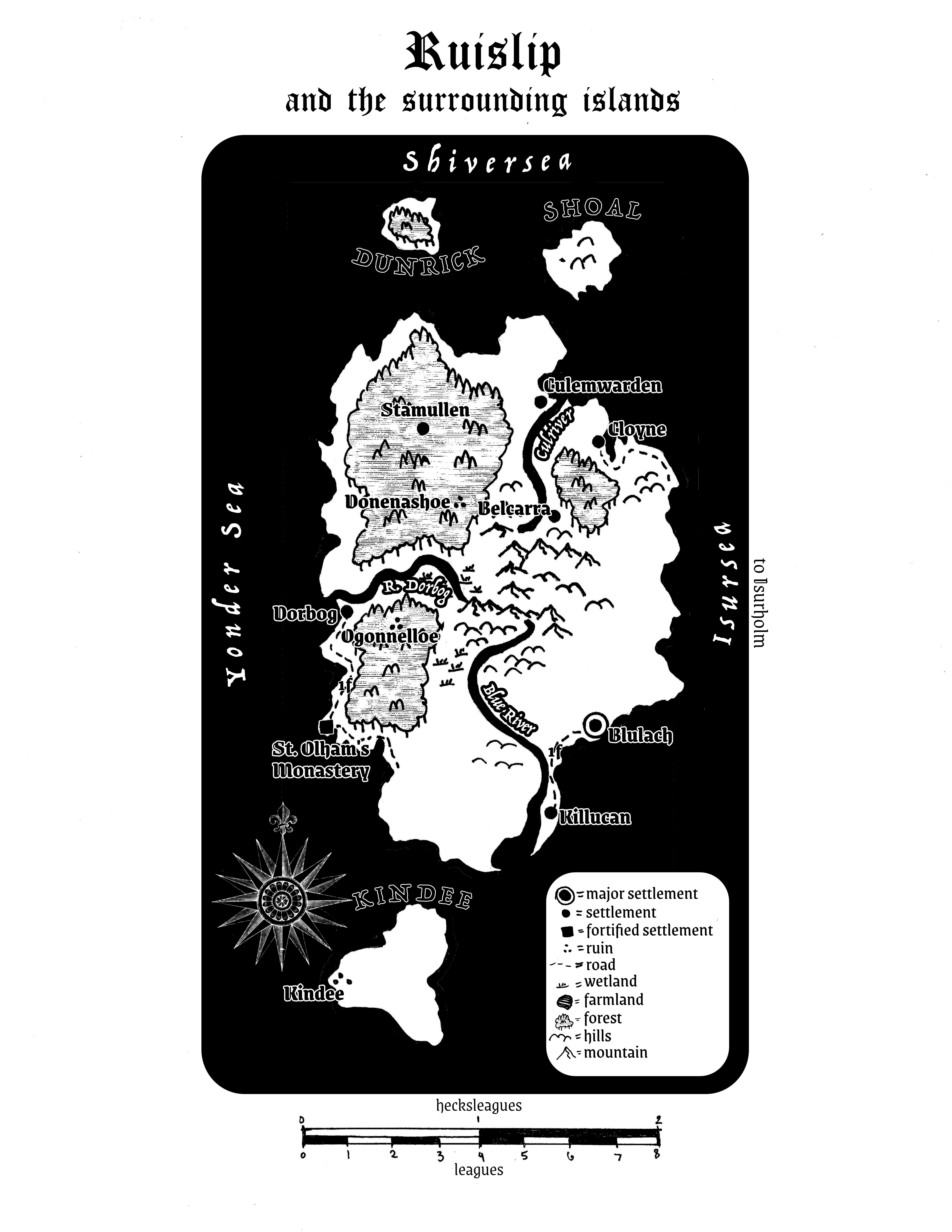
One of our party (I won’t name names but it was Willem of course) insisted we actually do some surveying before drawing our maps and so we sailed for Ruislip, which the king wanted mapped as well for a potential conquest. We compromised by landing at Blulach, the only civilised place on the accursed island, having a few pints, and asking the locals about what was here.
A band of Aegerlings arrived in the night, itching for a fight, but they managed to get too drunk to start anything. Willem suggested we flee tonight deeper into the countryside before the raiders awaken and kidnap everyone in the pub and sell us off, but he’s been listening to too many campfire stories from these foolish adventurers.